Our Tools
Kota Kita develops various planning tools and makes them available in order to enhance understanding of urban issues and encourage more people to participate in urban planning processes. Most of the material currently made available about cities is of a technical nature used by government officials, engineers, and developers. We want to make participating in improving communities and cities fun and accessible for all.
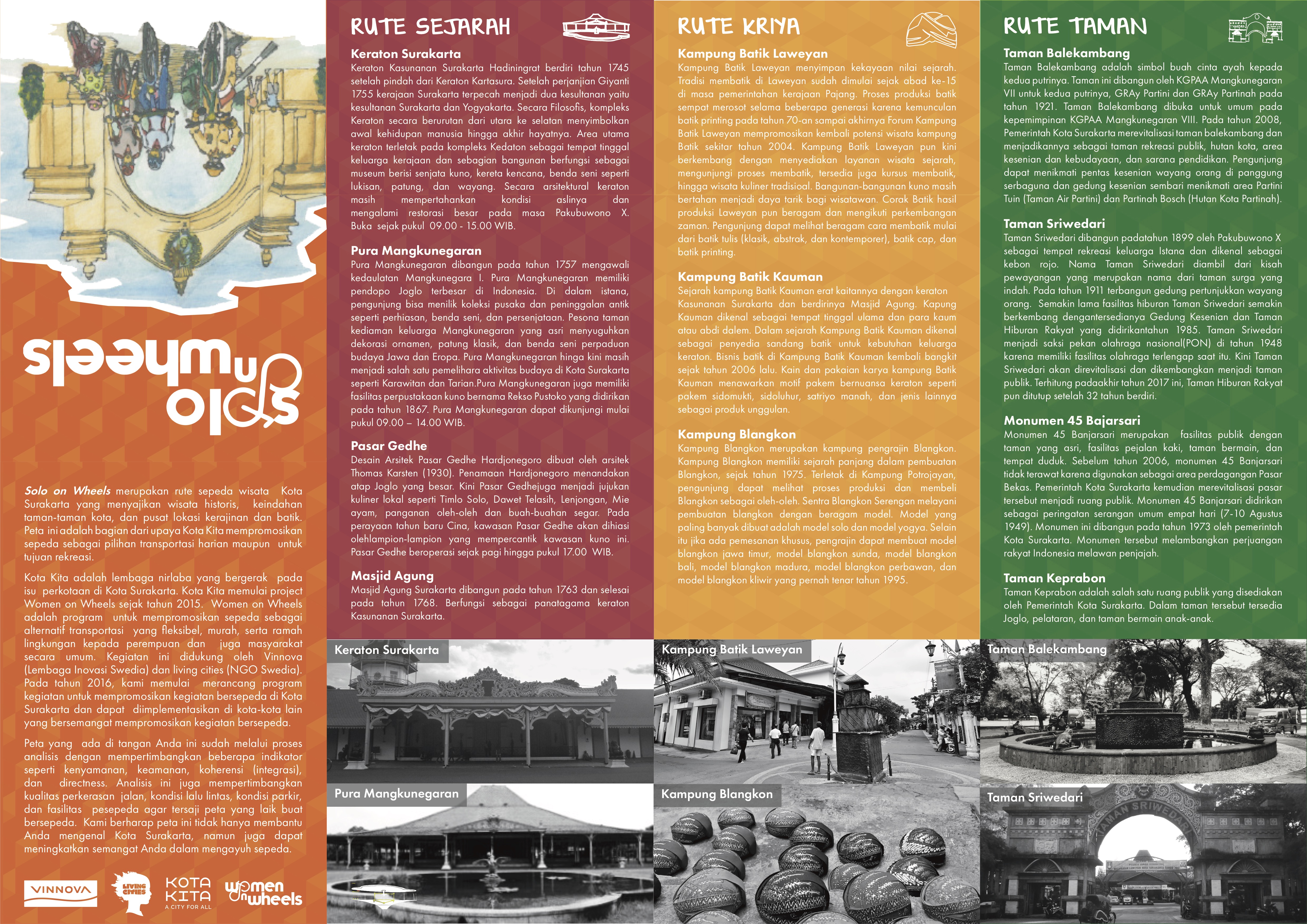
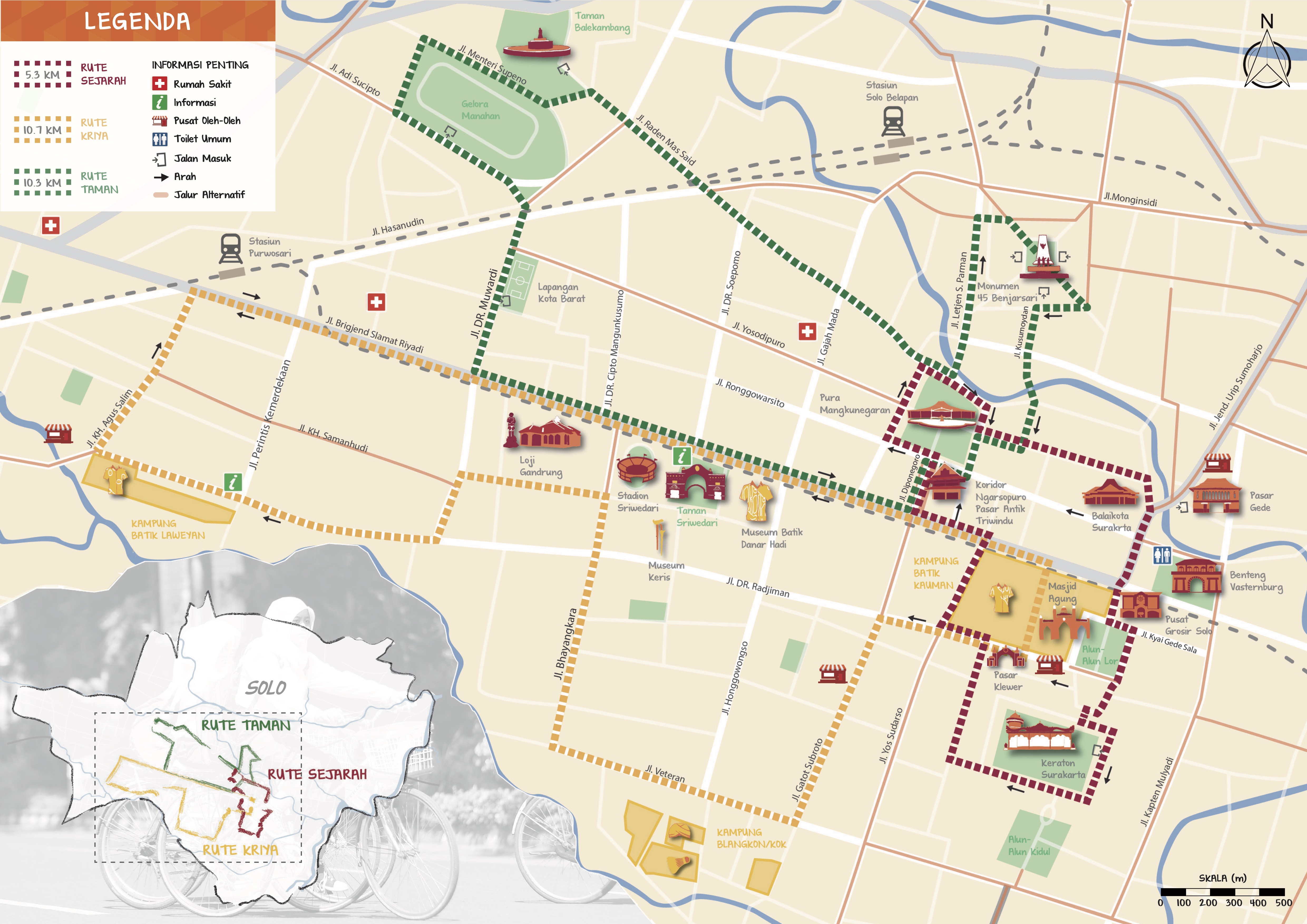
‘Solo on Wheels’ Bicycle Map
Solo bicycle map is designed by Kota Kita to encourage more people to enjoy the city using bicycle. It aims to mainstream the use of non-motorized transportation, as well as advocating for better infrastructure that support it. There are three thematic routes- following the type of destinations that it promote, each routes take into consideration supporting factors to use bicycle, like safety, distance, convenience (shade and availability of slow lane). The map will be available for free in public places in Solo.
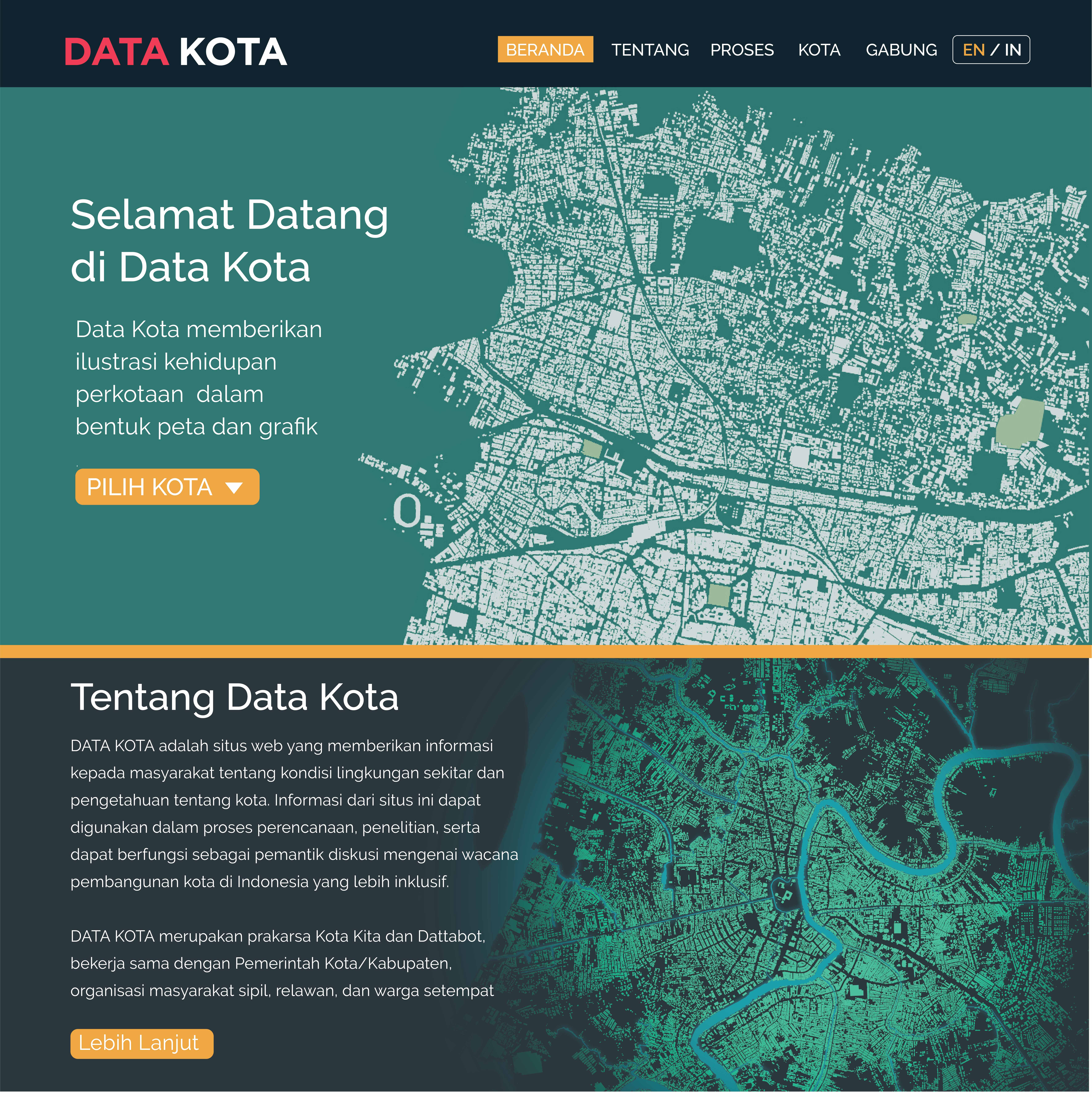
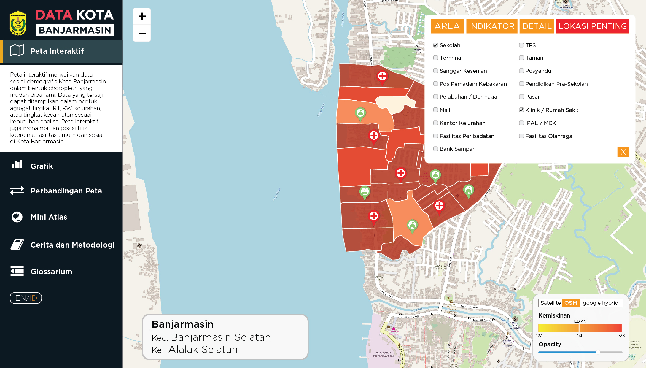
Data Kota
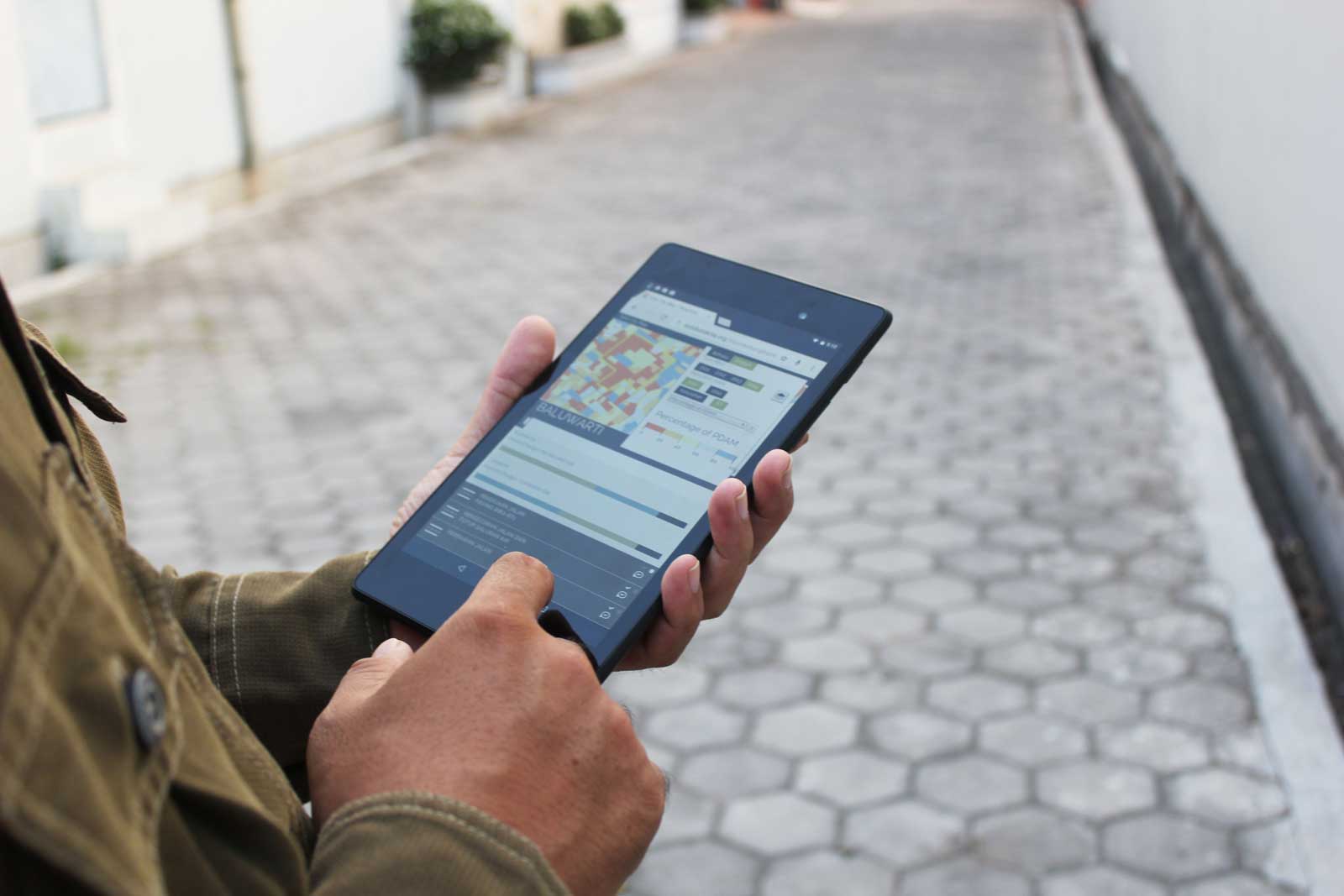
Data Kota is Kota Kita’s technology initiative to create an open and free, urban diagnostic platform of cities across Indonesia. The platform consolidates socio-demographic data and features an interactive map of each cities.The feature and design of the map helps to locate certain conditions, compare findings between neighborhoods and indicators, and finally, allows users to create and print their self-made Mini Atlases/ neighborhood profiles. The first Data Kota’s city initiative was made in collaboration with the City Government of Banjarmasin in 2016-2017.
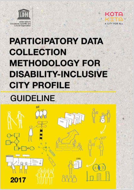
Participatory Methodology for Disability-inclusive City: Guideline Document and Video
Together with UNESCO, Kota Kita created Guideline Methodology document for Participatory Disability Data Collection. It is a manual that aims to introduce the process and step-by-step activities in developing the Disability-Inclusive City Profile which synthesized the process, learning and experience in Solo, Indonesia. This manual is an educational tool that can be used by anyone who has concern with disability issues and wishes to create a more inclusive city through provision of reliable data. Kota Kita also produced a video that captures the process of participatory data collection in Solo, Indonesia. The video is available in Bahasa Indonesia and English with subtitles.
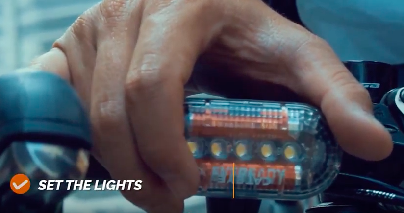
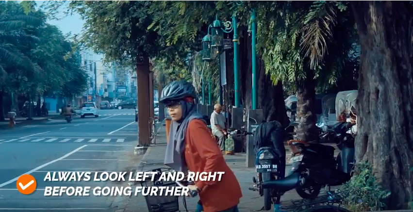
Safe Bicycle Practices Bilingual Video
Using a video, Kota Kita shares practical tips and traffic etiquettes, the dos and don'ts for urban cyclists. This video is a part of Women on Wheels program, an ongoing awareness raising campaign, to promote safer, more inclusive, and bicycle-friendly urban transportation system in Indonesian cities. The video is available in Bahasa Indonesia and English.
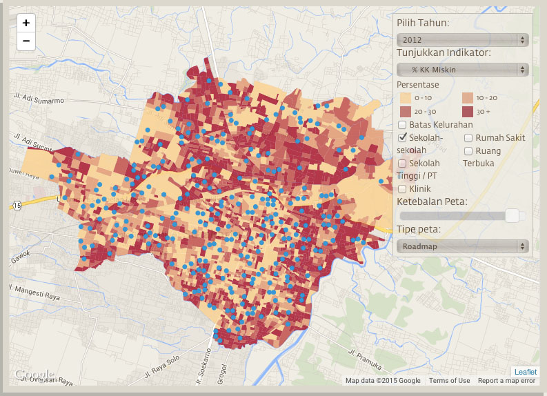
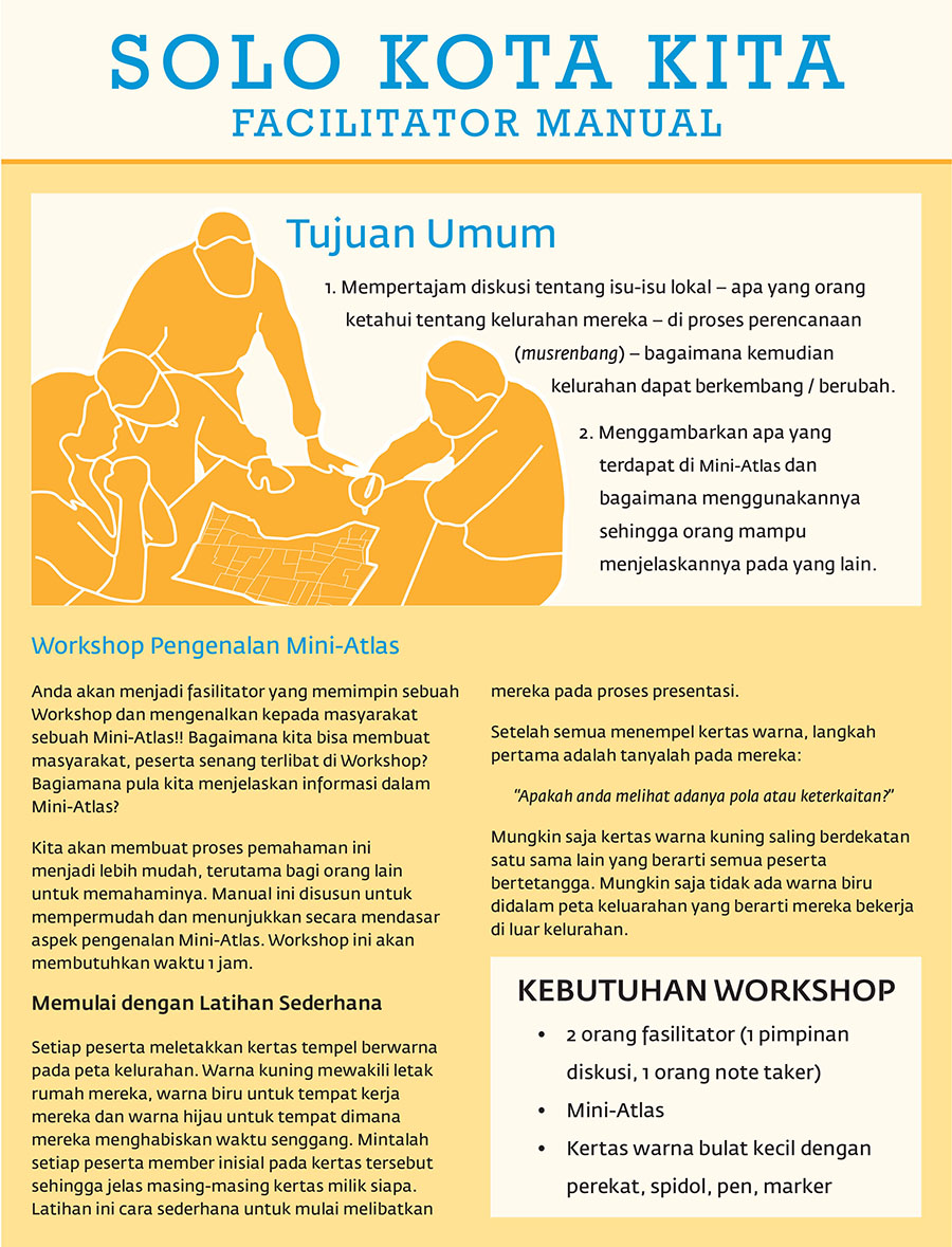
Solo Kota Kita
www.solokotakita.org
SoloKotaKita.org is Kota Kita’s first web app; it makes available up-to-date, fine grain information about the city of Solo in order to support the city’s participatory budgeting cycle, the Musrenbang. Selecting different layers of information, different neighborhoods, and different years allows citizens to research the needs of their communities. This information can be discussed with other citizens in order to prioritize infrastructure projects, compare one neighborhood with another, and advocate for specific services or needs using data.
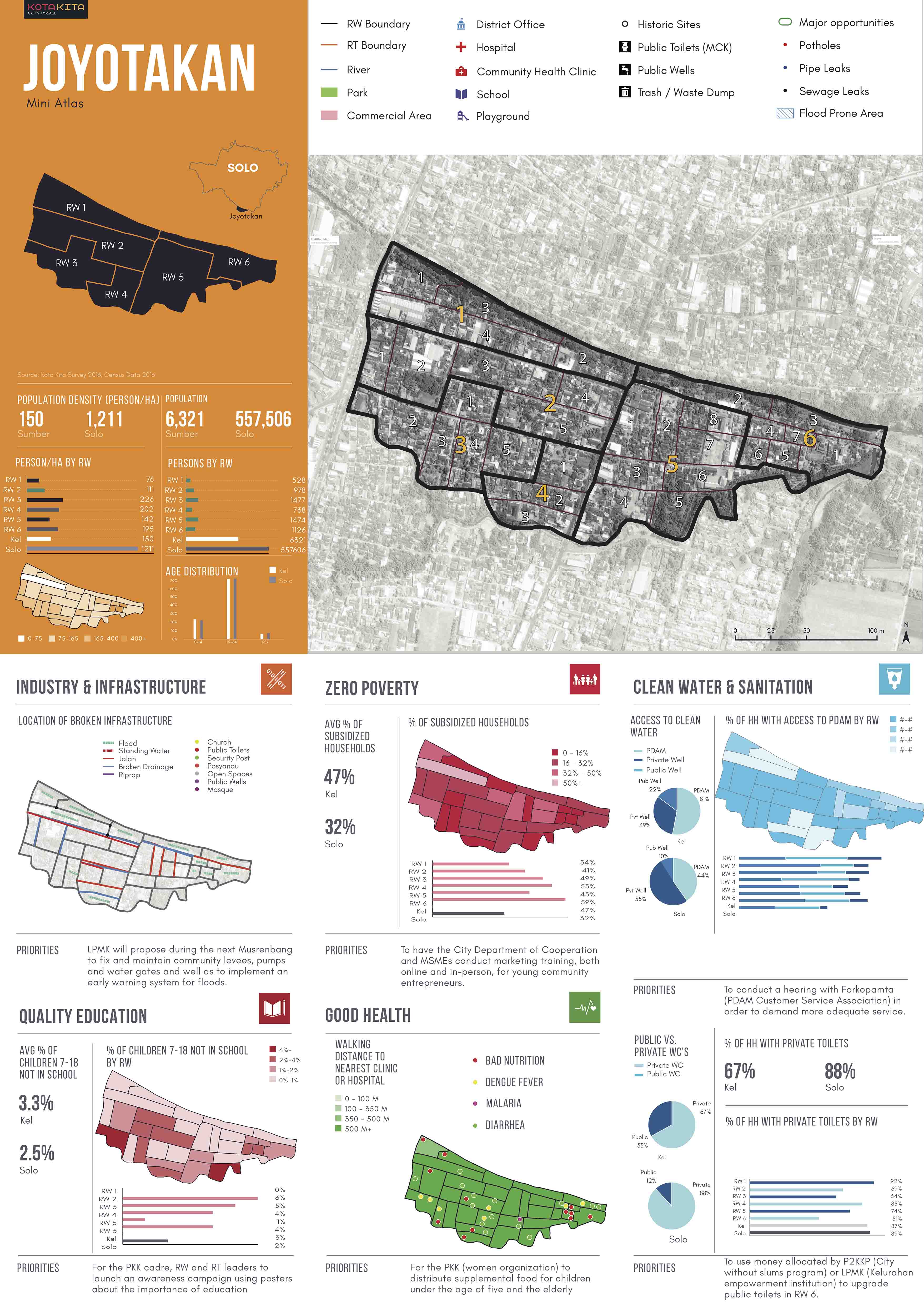
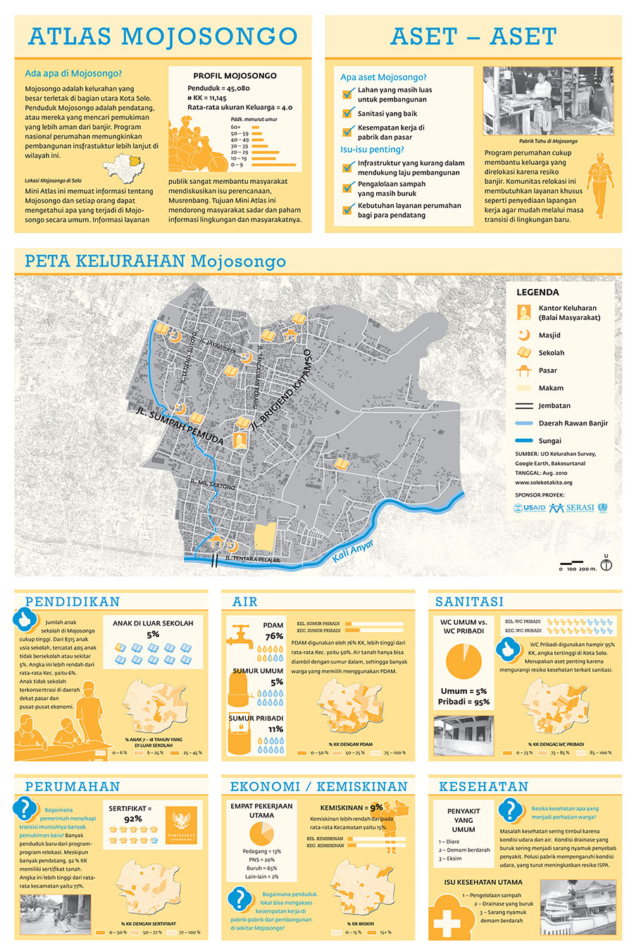
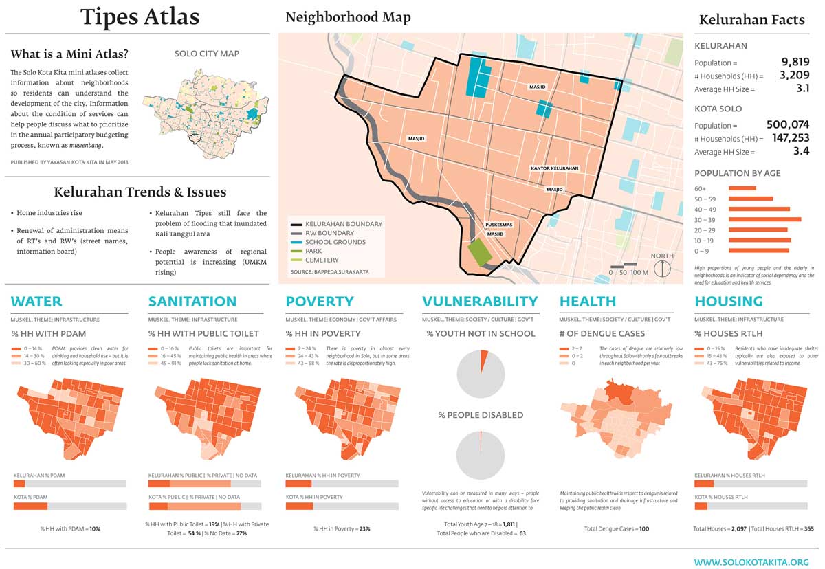
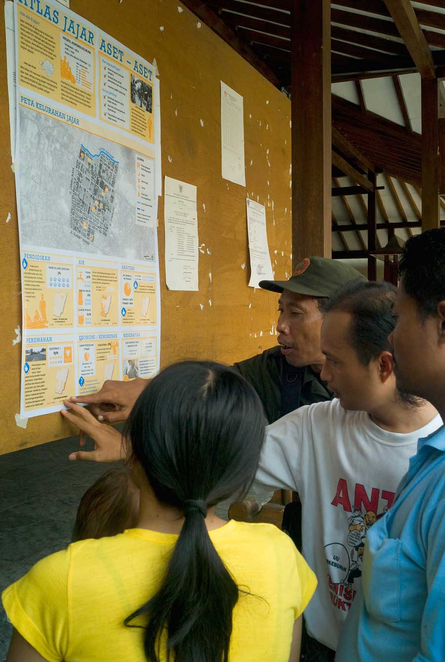
Mini Atlases
Mini Atlases are neighborhood profiles created for each of the city’s Kelurahans (neighborhoods). They present basic socio-economic and demographic information together with maps of the neighborhoods in a legible and easy-to-use format. The maps can be used by residents to support discussions about assets and issues within their neighborhoods.
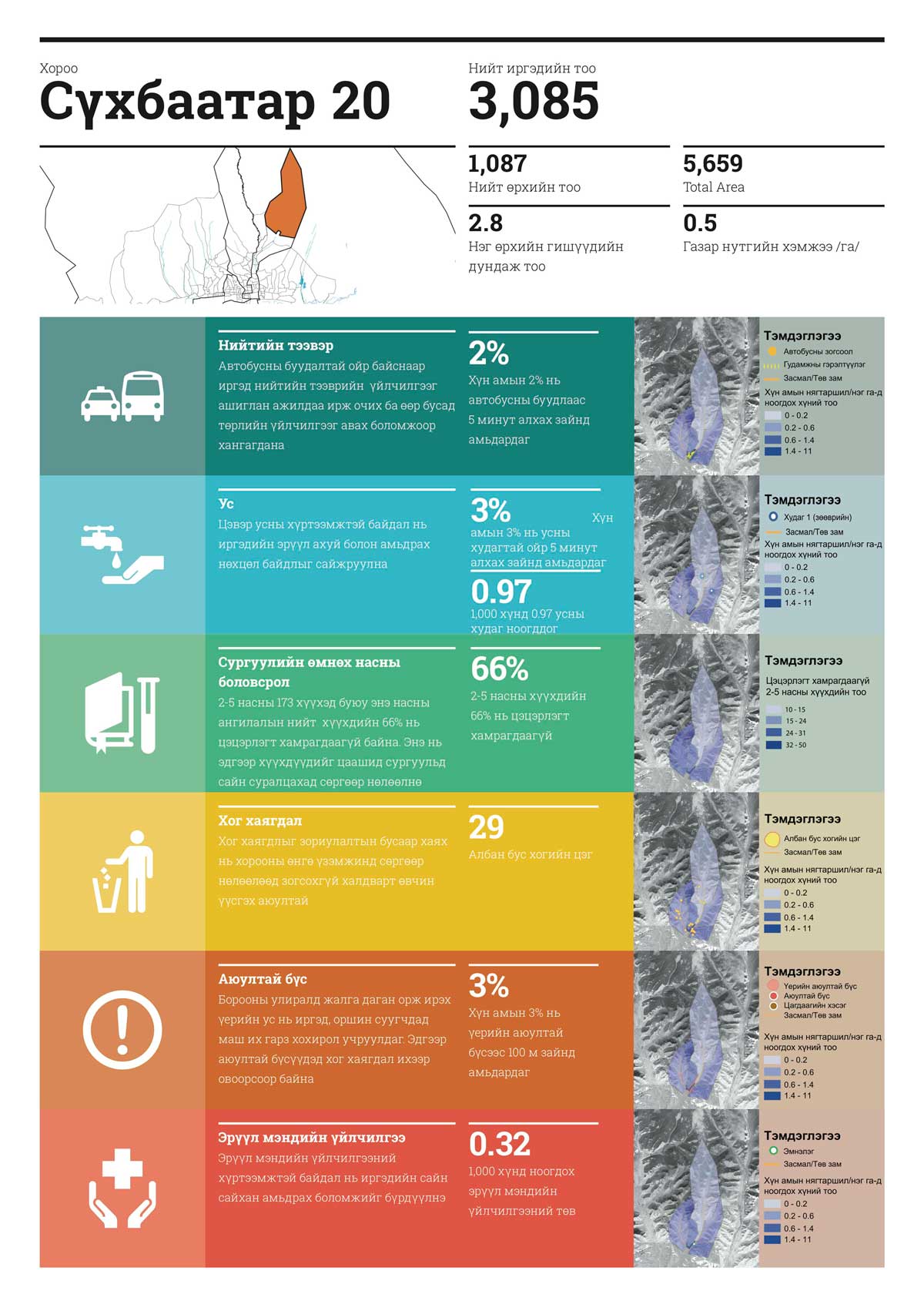
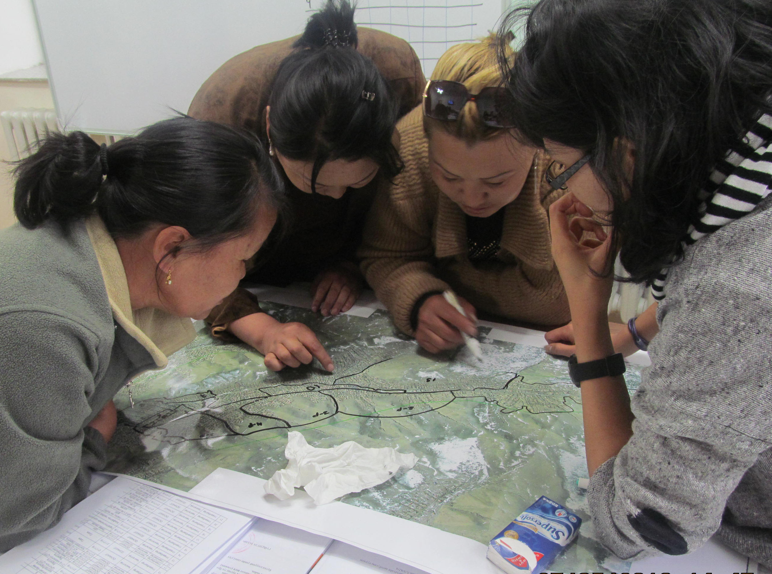
Manaikhoroo Neighborhood Profiles
Manaikhoroo, or ‘My Neighborhood’ in Mongolian, is a data collection and neighborhood profile design project that Kota Kita undertook with the City of Ulaanbaatar, Mongolia and The Asia Foundation. The information in each profile supports discussions between residents and local government on priority investments and improvements to public services. These are the first such maps of Ulaanbaatar’s unplanned ger settlements; there are 87 in total.
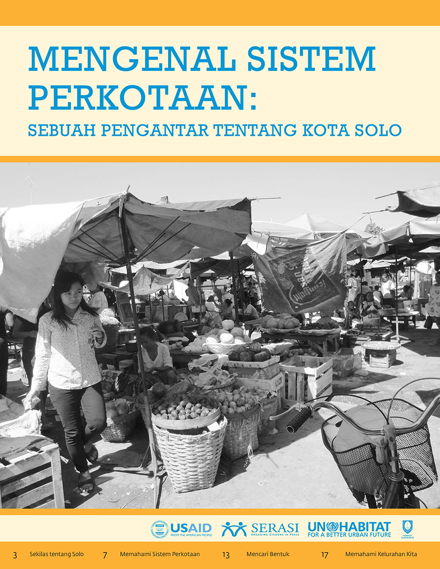
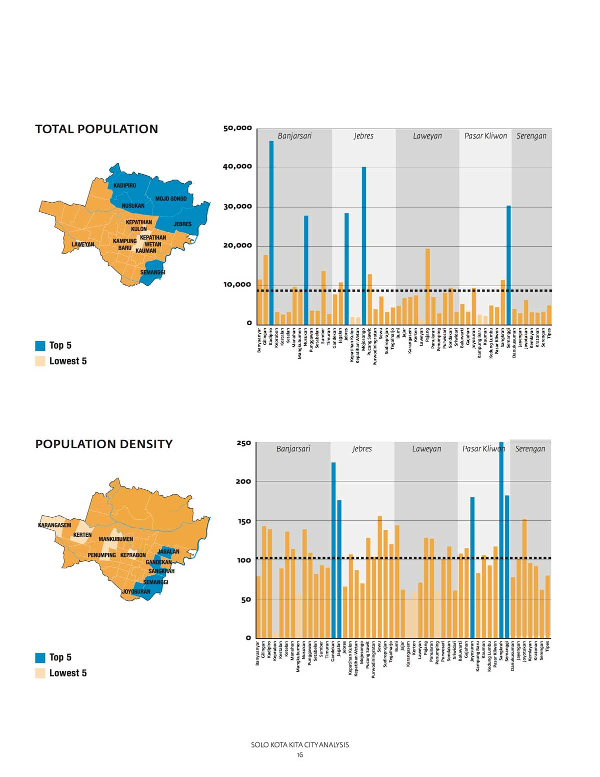
Solo’s City Systems
What’s going on in Solo? This guide provides a brief introduction to Solo, its neighborhoods, and its urban systems. How does what happens in your neighborhood relate to life in the city as a whole? How does your neighborhood rank in comparison to other neighborhoods in Solo? This guide provides information and analysis about the city of Solo, as well as comparative data about its many neighborhoods.
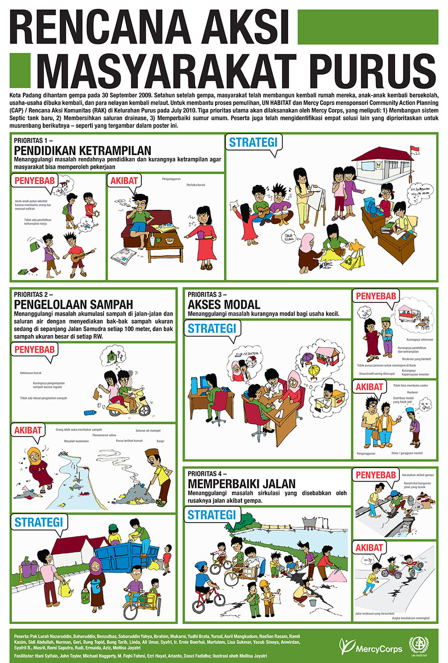
Community Action Planning poster
The Community Action Planning poster visualizes community re-building priorities following the earthquake in Padang in 2011. After the earthquake, a Community Action Planning process took place in Purus where residents discussed the priority issues that needed to be addressed by small infrastructure investments. The poster serves as a reminder of this workshop and the collective decisions taken to re-build after the disaster; it can be used as an advocacy tool to engage in planning efforts with local government.
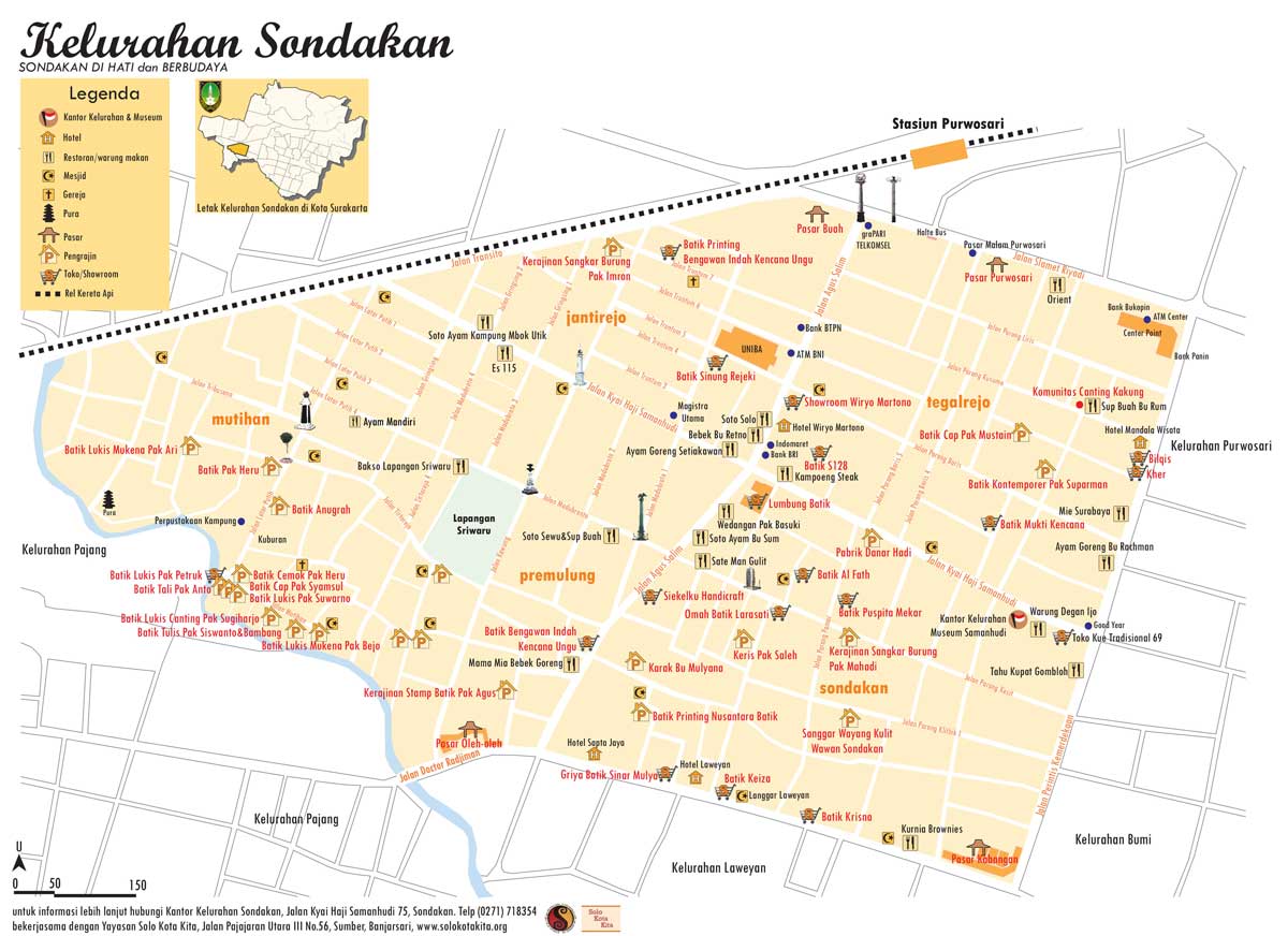
Tourism Map of Sondakan
To support the initiative of the local tourism committee of the neighborhood of Sondakan, Solo, Kota Kita helped to create a Tourism Map. The map was made together with residents, identifying the location of Batik workshops, restaurants, and cultural sites in the neighborhood. The Tourism Map helps residents provide guidance to visitors and promote the local economy.
Community Facilitation Guide
Our Community Facilitation Guide provides exercises to get started using the Mini Atlases for neighborhood planning.
Social Design Field Guide
Our field guide helps provide advice and information about how to facilitate participatory design processes. It answers questions such as ‘Who do you invite to meetings’ and ‘How do you facilitate meetings?’ The Field Guide documents a process that Kota Kita undertook in Banjarmasin, Central Kalimantan for a participatory urban design process called Firm Foundation. It walks readers through the tools used during the design workshops, the lessons learned from the process, and the design outcome.
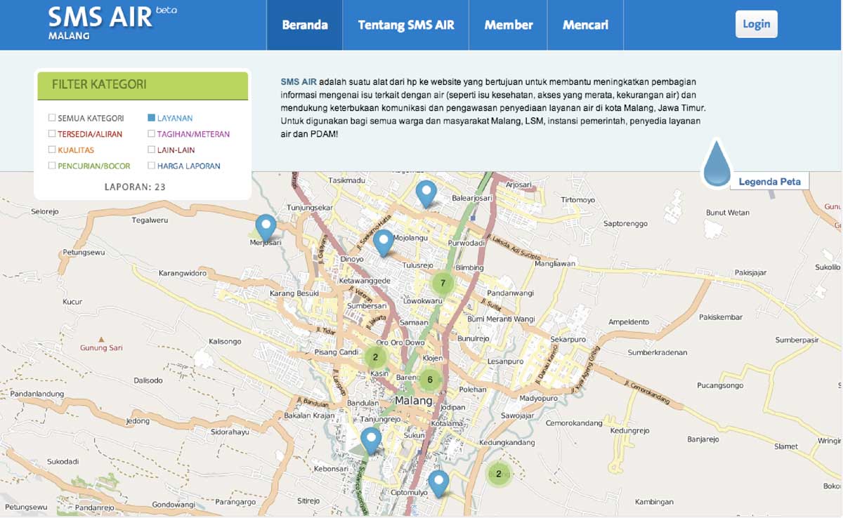
Water SMS
The Water SMS web app helps to visualize up-to-date issues related to water supply in the cities of Malang and Makassar. Clients of the city’s water supply service can send SMS messages to a hotline describing what the issue is and where its origin is. The web app visualizes this flow of data to provide municipal information as it emerges, for example, identifying leaks or poor services.
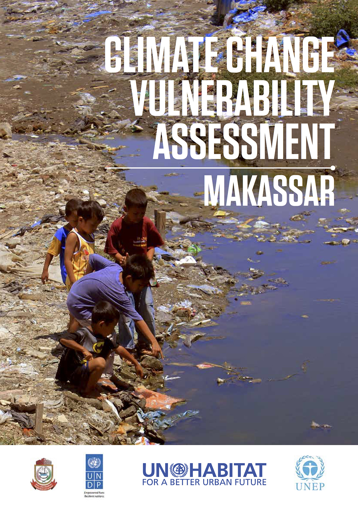
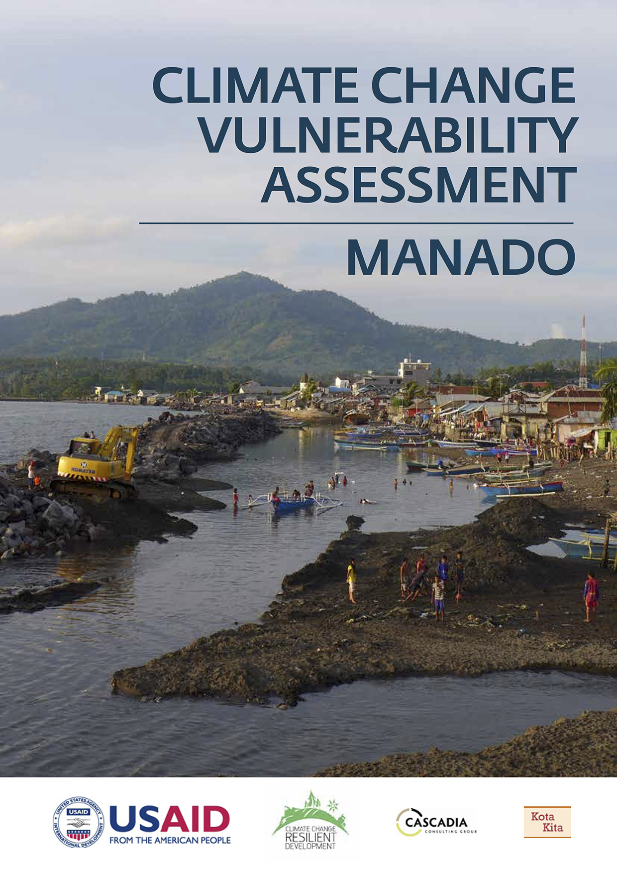
Climate Change Vulnerability Assessments
Climate Change Vulnerability Assessments are reports that support planning processes to build resilience to climate change. The process of carrying out the vulnerability assessments took place with the participation of civil society organizations and local officials from a variety of government agencies. The resulting report helps the city to identify issues, and prioritize needed policies and projects to reduce vulnerability and increase resilience.
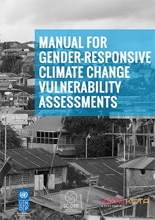
Manual for Gender-Responsive Climate Change Vulnerability Assessment
The Manual provides social leaders, NGOs, universities, community-based organizations or local governments with a tool to help undertake a gender-responsive climate change vulnerability assessment in their city. The Manual provides both a set of practical tools to assess vulnerability – such as a methodology about how to collect and analyze data, conduct workshops, and work with stakeholders – as well as offers educational material to educate readers about the impacts of climate change and urbanization on women.
The Manual draws from climate change vulnerability assessments conducted in the cities of Kupang, Makassar and Manado to provide context and provide examples about how gender-sensitive issues related to climate impacts can be better evaluated and understood – leading to better adaption planning and gender-responsive policymaking.
Musrenbang Tracker
The Musrenbang Tracker (or Mus-Tracker for short) is an online application that provides residents of Solo greater access to information about the selection and implementation of small-scale infrastructure projects in their neighborhoods. The web- tool links a citywide database to a web browser that can be accessed by anyone with Internet, for example through his or her Smart phone or laptop. Residents can track individual projects that they voted on and monitor their status, as well as make comments about these projects. As a result the public is able to actively participate in monitoring and overseeing the implementation of projects. The Mus-Tracker offers a younger, more tech-savvy population the opportunity to become involved in neighborhood development.
The Mus-Tracker can be found at www.solokotakita.org/musrenbangtracker
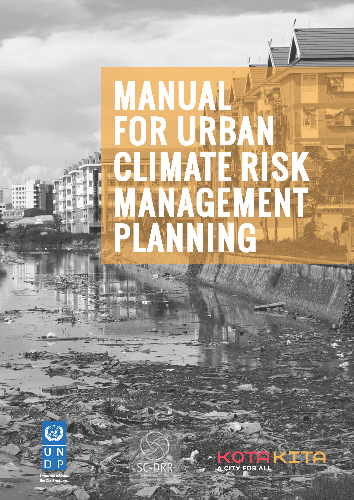
Manual for Urban Climate Risk Management
This Manual is designed to support local governments, NGOs, consultants and universities to create an Urban Climate Risk Management Plan. The Manual offers a guide for a participatory process of resilience planning; this process includes translating recommendations from a Climate Change Vulnerability Assessment into a set of prioritized actions, through discussion, analysis and eventually the creation of an official planning document.
One of the key features of the Manual is guidance about how to create a city working group who’s role it is to monitor and evaluate the action plan, and ensure its effective implementation. The Manual draws on a similar process conducted in the City of Makassar, providing examples and identifying issues encountered from that city.